The project was approved by the Managing Authority of Operational Programme Transport 2007-2013 on 03.09.2012.
Deadline: Start: 09.10.2013; End: 30.09.2015.
Beneficiary: Executive Agency for Exploration and Maintenance of the Danube river (EAEMD)
Budget: Total value of the project: BGN 3,488,507
Sources of funding:
European Regional Development Fund: BGN 2,965,231
National co-funding: BGN 523,276
The project is funded under Priority Axis IV “Improvement of the maritime and inland-waterway navigation” of Operational Programme Transport 2007-2013.
Main activities under the project:
- Improving the navigation systems which play an important role in ensuring safe navigation on the Danube river.
- Modernising and updating the monitoring networks and methods for data collection, processing and analysis that enable a qualitative and quantitative assessment of the waters of the Danube river in line with the requirements laid down by the World Meteorological Organization (WMO), the Danube River Protection Convention, the Water Framework Directive (WFD), and the International Commission for the Protection of the Danube river (ICPDR).
- Complying with international standards on carrying out topographic (geodetic) surveys in combination with hydrographic and hydrologic activities necessary in order to study changes in inland waterways (Danube river), regulated by Art. 70 of the Law on the Maritime Spaces, Inland Waterways and Ports of the Republic of Bulgaria.
- Aligning the quality of designating navigation conditions in the common Bulgarian-Romanian section of the Danube river.
- Reducing the time for providing information to citizens and legal persons (operating on the river) as a type of service concerning the water status of the Danube river and the navigation path.
- Restoring and improving basic infrastructure in terms of the supporting geodetic network along the Danube river.
The implementation of the project is divided into the following activities:
- Activity 1: Setting up a supporting GPS geodetic network along the Bulgarian bank of the Danube river and connecting it to the EUREF
- Activity 2: Purchasing and installing automatic hydrometric and meteorological stations
- Activity 3: Purchasing floating and coastal navigation signs along the Danube river
- Activity 4: “Purchasing a specialised vessel for hydrographic surveying” will be implemented as phase 2 of the project in the next programming period and will be funded under Operational Programme Transport and Transport Infrastructure 2014 – 2020
Project contractors
Contract No. Д-46/24.09.2014 was concluded with Geo-Chonov Ltd. to set up a supporting GPS geodetic network along the Bulgarian bank of the Danube river.
Contractor: Geo–Chonov Ltd.
Value: BGN 395,535.60 including VAT
Deadline for implementation: 15.04.2015
The network is the starting basis for: surveying changes in the river banks and the bed of the Danube river in order to reflect them when updating the electronic navigational charts; carrying out activities aimed at developing infrastructure in the river — constructions such as pier walls; coast-protection equipment and facilities allowing to change the direction and/or flow rate of the water current in order to improve navigation conditions in the common Bulgarian-Romanian section.
The network consists of 89 main points located at a distance of 5 to 8 km, and it is mandatory to establish points near the hydrometric stations of the EAEMD and the hydrometric profiles of the EAEMD for quality monitoring of the waters of the Danube river.
Each geodetic point of the network is supported by two orientation points, whereby the geodetic point and one of the orientation points are supported by an underground centre.
Contractor: Lomini Ltd.
Value: BGN 951,103.20 including VAT
Activity implementation period: 09.09.2013 – 26.03.2014
Activities:
9 automatic hydrometric and meteorological stations delivered and installed.
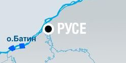
Mounting and installation of 9 electronic panels in the following towns and villages: Novo Selo, Vidin, Lom, Oryahovo, Nikopol, Svishtov, Ruse, Tutrakan, Silistra.
Parameters measured by the mobile equipment: water surface level of the Danube river,
water temperature, turbidity, air temperature and humidity, wind speed and direction, rainfall, intensity of rainfall, atmospheric pressure, solar radiation, visibility.
The collected data are displayed on electronic panels.
Contract No. Д-40 of 28.07.2014 was concluded between the EAEMD and Elta-R-Chenkin & Co SD (General Partnership)
Contractor: Elta-R-Chenkin & Co SD
Value: BGN 2,064,600 including VAT
Deadline for implementation: 23.04.2015
Within this activity coastal and navigation conditions will be upgraded.
- Designing and manufacturing floating navigation signs;
- Delivery of solar lighting equipment and control sensors for floating and coastal signs along the Bulgarian coast;
- Setting up floating and coastal signs in line with the GPS geodetic network implemented and current navigation conditions.
- Delivery of 160 floating navigation signs (buoys);
- Delivery of 980 coastal navigation signs;
- Delivery of 20 coastal lighthouses;
- Integrating a real-time control system concerning the location of floating signs and lighthouses.


 Up
Up


